Asheville, North Carolina, September 27, 2025
News Summary
A cold front combined with tropical moisture from Hurricane Humberto and Invest 94L presents a flood threat to North and South Carolina. Areas like Asheville, still recovering from Hurricane Helene, are particularly at risk for heavy rainfall, with projections of 3 to 6 inches over the coming week. Officials are urging residents to prepare for potential flash flooding as meteorologists continue to monitor the developing weather systems.
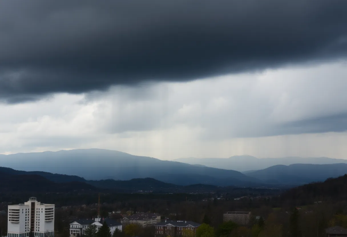
Asheville, North Carolina – A cold front moving through the Southeast is set to join tropical moisture from Hurricane Humberto and Invest 94L, creating a flood threat over the weekend and extending into next week. Areas in North and South Carolina, still recovering from Hurricane Helene, are particularly at risk for heavy rainfall and possible flash flooding.
The cold front is expected to stall near the Southeastern coast, leading to significant rainfall in the Carolinas. Rainfall totals through Saturday are projected to range from 1 to 2 inches, with the potential for heavier downpours that could bring totals of 2 to 3 inches or more. A level 2 out of 4 flash flood threat has already been issued for much of Western North Carolina, including Asheville, a city that experienced severe flooding from Hurricane Helene last year.
Flash flooding is a major concern, with forecasts indicating the possibility of 3 to 6 inches of rain over the upcoming week. The most significant impacts from rainfall are expected to stretch from Washington D.C. to South Carolina. Meteorologists warn that organized rain may continue into next week, alongside normal showers and storms.
Current Weather Systems
The National Hurricane Center is actively monitoring Invest 94L, which has the potential to develop into Tropical Storm Imelda. Meanwhile, Hurricane Humberto, currently off the coast with sustained winds of 75 mph, is not expected to make landfall; however, it could still influence weather patterns along the U.S. East Coast.
Uncertainty remains regarding the exact path and intensity of the upcoming tropical systems. The potential for a predecessor rain event (PRE), similar to those that caused flooding during Hurricane Helene, is a concern for the week ahead. The Hurricane Hunters are scheduled to investigate Invest 94L in an effort to assess its potential impact on the region.
Community Preparedness
As communities within the Blue Ridge Mountains continue to recover from Hurricane Helene’s aftermath, residents are advised to stay vigilant and prepared for severe weather. Local authorities are issuing warnings for those living in flood-prone areas to take necessary precautions, such as preparing an emergency kit and avoiding travel during heavy rain.
It is essential for residents to monitor local forecasts for updates on the flooding situation and the development of any tropical systems in the Atlantic. The risk of severe weather is increasing as the cold front interacts with tropical moisture from offshore systems.
Key Points for Residents
- Flooding potential due to a cold front interacting with tropical moisture from Hurricane Humberto and Invest 94L.
- Flash flood threat level set at 2 out of 4 for Western North Carolina.
- Rainfall of 3 to 6 inches possible over the next week.
- Invest 94L being monitored as it could become Tropical Storm Imelda.
Conclusion
Residents of North and South Carolina are advised to stay informed and prepared for potential flooding impacts as the weather systems develop over the coming days. Emergency management officials recommend staying updated with real-time weather alerts and following guidance from local authorities.
FAQ
What is causing the flood threat in the Carolinas?
A cold front is moving through the Southeast and is set to join tropical moisture from Hurricane Humberto and Invest 94L, creating a flood threat over the weekend and into next week.
What is the expected rainfall in the Carolinas?
Rainfall totals through Saturday are expected to range from 1-2 inches, with a possibility of lingering heavy downpours resulting in 2-3 inches or more.
Is there a specific area at greater risk for flooding?
Many areas in Western North Carolina, such as Asheville, are particularly at risk as they are still recovering from Hurricane Helene.
Key Features Summary
| Feature | Description |
|---|---|
| Weather Systems | A cold front interacting with moisture from Hurricane Humberto and Invest 94L. |
| Flash Flood Threat | Level 2 out of 4 for much of Western North Carolina. |
| Expected Rainfall | 3 to 6 inches of rain possible over the next week. |
| Invest 94L | Being monitored for potential development into Tropical Storm Imelda. |
Deeper Dive: News & Info About This Topic
HERE Resources
Asheville Faces Heat Wave and Thunderstorm Threats
North Carolina’s Outer Banks Faces Hurricane Erin Evacuations
Severe Weather Warnings Issued for Western North Carolina
Asheville Faces Record Low Temperatures and Cultural Revivial
Asheville Faces High Heat and Scattered Thunderstorms
Tropical Depression 3 Develops Off the Southeastern U.S. Coast
Tropical Storm Helene Devastates Small Farms in Western North Carolina
Heavy Rain and Flooding Ahead: Prepare for an Atmospheric River!
Severe Weather Alert Issued for Western North Carolina
Winter Storm Approaching Western North Carolina
Additional Resources
- Fox Weather: Tropical Moisture and Flood Threat
- Herald Sun: Weather Update
- ABC11: Flood Risk in Central North Carolina
- Wikipedia: Flood
- Google Search: Flood Risk in Carolinas